By The Antiplanner
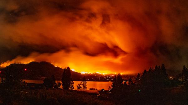
The Antiplanner’s exurban area has been filled with smoke the last few days as winds have blown soot from wildfires in western Oregon towards central Oregon. As bad as the air has been here, it usually wasn’t as bad as it was in New York City a couple of months ago due to fires in Canada.
Canada has seen more land burn so far this year — more than 34 million acres as of August 18 — than any full year in its history: the previous record was 17.5 million acres for all of 1995. The Maui fires, of course, have had unprecedented impacts, with at least 115 known dead to date and more than 1,000 missing. Many are blaming these fires on or saying they are evidence of human-caused climate change.
Recent fire history of the rest of the United States, however, doesn’t support those claims. As of yesterday, a total of 1.8 million acres in the 49 states other than Hawaii have burned, just 37 percent of the previous 10-year average up to this date of 4.8 million acres. The year isn’t over yet, but fewer acres have burned so far this year than by the same date in any of the previous ten years.
The National Interagency Fire Center “situation report” shows acres burned broken down by 10 different regions, and all but the Eastern Region have seen less fire this year than the previous 10-year average. The Eastern Region typically sees less than 1 percent of total annual acres burned, so the 2023 high isn’t very important.
So far this year, Northern California has seen only 4 percent of the acres burned in the previous 10 years. The Great Basin is 14 percent, Alaska is 21 percent, and the central and northern Rockies are under 40 percent. Other than the East, only southern California is close to its 10-year average at 85 percent.
Nationally, the worst fire year since 2012 was 2015, when more than 7.4 million acres burned. But that was mainly because of large fires in Alaska.
On a region-by-region basis, no single year stands out as worst for the entire country. The closest is 2021, which was the worst fire year for three regions — northern California, the northern Rockies, and the East — but was a relatively mild fire year for Alaska and southern California.
The worst fire year for the Pacific Northwest was 2014, when hardly any acres burned in southern California. Alaska’s worst was in 2015, which was a mild fire year in the South. Southern California saw the most acres burn in 2016, when few acres burned in northern California. The Great Basin and South both peaked in 2017, when burning in the East was at its minimum. The central Rockies were in 2018, when fires were minimal in the northern Rockies. The Southwest’s worst was 2022, when fires were minimal in southern California.
The United States represents only a small portion of the earth’s surface, but this shows there is no general trend in this nation, and anyone who claims that particular fires are evidence of climate change is ignoring the broader picture.
We know the Maui fires were severe not because of climate change but because of invasive grasses in farms abandoned due to the state’s restrictive land-use laws. Some western states have seen record-sized fires in recent years because firefighting agencies have changed firefighting strategy to protect firefighter lives by allowing more acres to burn. It may be that this year’s record fires in Canada also have a local explanation rather than the generalized “climate change.”
The Antiplanner is a forester and economist with more than fifty years of experience critiquing government land-use and transportation plans.
Originally published by The Antiplanner. Republished with permission.
To read more about Canada’s wildfires, click here.
To read more about fire data, click here.


